This year I didn't get my usual Alaska Range caribou tag, thanks to some last-minute indecision and confusion in which I missed the deadline to apply. So I was restricted to "general harvest" zones, of which the most accessible and promising is the north slope of the Brooks Range up the Dalton Highway (locally, the "Haul Road").
"Accessible" in this case is relative, and here it means "airplane not required." The hunting area is a 10+ hour drive from the nearest town (Fairbanks) north into the Arctic, with gas available only at a single truck stop at the half-way point in Coldfoot. Bowhunters can make this drive and pursue caribou along a couple hundred miles of road on the slope and coastal plain, but my bow in recent years joined my first 5-weight fly rod in the section of sporting gear heaven reserved for things I left on top of my car while driving off.

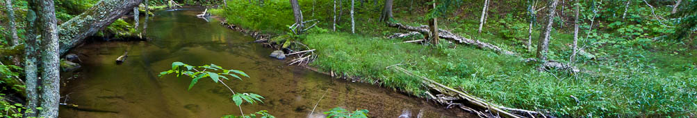
As a rifle hunter, I would not be allowed to shoot anything within five straight-line miles of the road, a zone known as the "Dalton Highway Corridor." (I once calculated the exact boundary line of this corridor as a fun math project and now sell it online for people to load on their GPS units.) There are a few different ways to handle the five-mile requirement, none of them easy on the swampy, tussock-laden north slope tundra. Some just backpack in with their gear and backpack out (two or three round trips, if solo) with their caribou in a ritual known as the "death march." Some drag gear and meat across the top of the tussocks in a sled. Others take shallow-water boats or line canoes up one of the eastern tributaries of the Sagavanirktok (Sag) River, a large system that heads in the high cirque glaciers of the Brooks Range and parallels the road and pipeline most of the way to the Arctic Ocean. I went for a hybrid hike-in/float-out plan using my PR-49 packraft, a 15-pound boat I could roll up and strap to the bottom of my backpack.

A gentle pool made for an easy crossing of the Sag below the pictured rapids. Other hunters tried to bring canoes down through the riffle and flipped one of them in the big wavetrain, but they had things under control.

I parked near the confluence of the Sag and the Ribdon River, the tributary I would use to hopefully exit with caribou meat. I hiked to the Sag, which at 2500 CFS could not be safely crossed on foot, then blew up my packraft, crossed the river, and rolled the raft back up to continue on my hike after scouting the whitewater around the confluence.

Fun whitewater under normal circumstances, but not to be trifled with on such a remote solo hunt.
The roiling Class II (by Alaska standards) boulder gardens of the last half-mile of the Ribdon looked like a fun time in the raft with a drysuit and some partners. But caution reigned supreme in this solo hunt on the edge of the Arctic winter, so I planned my strategy for walking the raft on a rope down through this stretch ("lining" it) instead of floating. This was no place for a repeat of last year's rafting fiasco.
After scouting the lower water, I hiked east along the easiest paths, alternating between gravel bars along the river and little ridges of high, dry ground overlooking the braided river plain. ("Dry" another relative term; it means fish could not live in my boot tracks.) Far below, some other hunters I met back at the parking lot were lining canoes up the river.

Willow ptarmigan flushed or fled on foot in front of me more than once. I watched a large musk ox wander the far shore of the Ribdon, then found the rest of its herd around the next bend. There was a wolf track in the sand along the river, and caribou tracks, but disconcertingly few of them, and almost none were fresh.


I saw no other sign of caribou throughout the day, and arrived at the 5-mile corridor (after a longer, zig-zagged, diagonal hike in) with just enough time to make camp before dark on a beautiful flat spot in the tundra next to a pool of standing water.