Blog & Latest Updates
Fly Fishing Articles
Insects by Common Name
> > Denali Highway
Landscape & scenery photos from Denali Highway

StateAlaska
LocationDenali Highway
Date TakenSep 18, 2011
Date AddedSep 25, 2011
AuthorTroutnut
CameraCanon EOS 20D

Along the roadside of the Denali Highway, a hunter more successful than I had a good sense of humor.
StateAlaska
LocationDenali Highway
Date TakenSep 19, 2011
Date AddedSep 25, 2011
AuthorTroutnut
CameraCanon EOS 20D

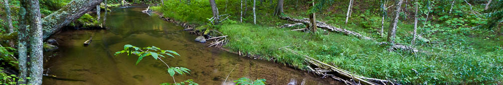
StateAlaska
LocationDenali Highway
Date TakenSep 18, 2011
Date AddedSep 25, 2011
AuthorTroutnut
CameraCanon EOS 20D

StateAlaska
LocationDenali Highway
Date TakenSep 18, 2011
Date AddedSep 25, 2011
AuthorTroutnut
CameraDMC-LX3

StateAlaska
LocationDenali Highway
Date TakenSep 18, 2011
Date AddedSep 25, 2011
AuthorTroutnut
CameraDMC-LX3

Mount Hayes. This 13,832-foot mountain is the tallest in the eastern Alaska Range.
StateAlaska
LocationDenali Highway
Date TakenSep 14, 2013
Date AddedSep 20, 2013
AuthorTroutnut
CameraCanon EOS 20D

Glacier Gap. This notch in the mountains two miles north of the highway holds a sizable lake.
StateAlaska
LocationDenali Highway
Date TakenSep 15, 2013
Date AddedSep 20, 2013
AuthorTroutnut
CameraCanon EOS 20D

Tundra puddle
StateAlaska
LocationDenali Highway
Date TakenSep 5, 2013
Date AddedSep 9, 2013
AuthorTroutnut
CameraNikon Coolpix P7700

Kettle lakes and the Alaska Range
StateAlaska
LocationDenali Highway
Date TakenSep 15, 2013
Date AddedSep 20, 2013
AuthorTroutnut
CameraNikon Coolpix P7700

Looking back at the Clearwater Mountains from the east
StateAlaska
LocationDenali Highway
Date TakenSep 15, 2013
Date AddedSep 20, 2013
AuthorTroutnut
CameraCanon EOS 20D
Recent Discussions of Denali Highway
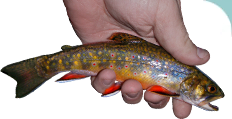
Grayling Fishing 1 Reply »
Glad you didn't give away all the good fishing holes on the Denali Highway. Lived up there for 23 years and that road has some of the best Grayling fishing I've ever seen. I know there are a dozen little streams names Fish Creek in AK, but am wondering if the Fish Creek in your pictures in the same as the one on the Denali Highway. Nice Job
ReplyStart a Discussion of Denali Highway:
Top 10 Fly Hatches
Top Gift Shop Designs
Eat mayflies.
Top Insect Specimens
Miscellaneous Sites
Troutnut.com is copyright © 2004-2024 Jason
Neuswanger (email Jason). See my FAQ for information about use of my images.
 privacy policy