Blog & Latest Updates
Fly Fishing Articles
Insects by Common Name
> > Bushwack Fishing
| FisherOfMen | January 14th, 2012, 8:43 pm | |
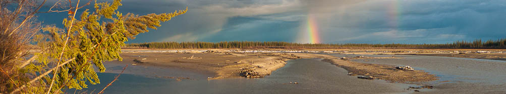
 Posts: 115 | Hey all- After talking with a local guide about his own backwoods fishing experiences, I ended up wondering how many people do just what he did. In his case, he and two buddies studied Google Earth until they found a pristine location - A stand of hemlock and spruce tight to the banks of a large pool at the end of a deep ravine. The whole combination kept the pool very cool even in the hottest day of summer. They took kayaks upstream 2 1/2 hours to get to this one point. They drew straws to see who would cast first. If I'm remembering right, they each pulled out a 17, 16, and 18 inch wild brook trout in that order. Anyone had any similar experiences? What I mean is, has anyone just picked a spot on a map, bushwacked through the mountains to get there, and then fished their targeted portion of stream? I'm curious as to how prevalent this type of fishing is. It's hard work, but definitely worth it. | |
| "Nothing makes a fish bigger than almost being caught." -Author Unknown All that is necessary for the triumph of evil is that good men do nothing. -Edmund Burke | ||
| Troutnut | January 15th, 2012, 12:32 am | |
 Administrator Bellevue, WAPosts: 2737 | Yeah, I have. One time I remember most vividly, I bushwhacked through a mile of soggy alder swamp only to find myself at a stream far too alder-choked to fish from shore and far too deep to wade. I don't think I even made a cast. I can't say that I've ever found some secret spot off the beaten path full of big trout. Usually in a place so far out of the way, the place itself is the reward, and the trout are only better than elsewhere because you did more to earn them. | |
| Jason Neuswanger, Ph.D. Troutnut and salmonid ecologist | ||
| PaulRoberts | January 15th, 2012, 8:52 am | |
 Posts: 1776 | After talking with a local guide ...they each pulled out a 17, 16, and 18 inch wild brook trout in that order. Couple thoughts: First, before you lay any money down ...if that ever crossed your mind... unless that place has a large amazingly productive water associated with it -like a lake, pond, or beaver pond- those numbers are hyperbole at best. In the east, I did most of my reconnaissance by hoofing, but did use maps and satellite images some. Here in the "big open" west I use them much more. In the east I found topo maps and satellite images useful to find habitat parameters like bigger deeper pools, steep gulches or swampy lowlands that might indicate groundwater influx, or expanses of forested stretches that offer intact habitat and shade. Nothing beats hoofing though. Springs are easiest to find in dead of winter, and also in early summer mornings when good springs can create mist -sometimes a lot of it. There is one such stretch I can see through binocs from my mountainside home from miles away (Im in CO and can almost see Kansas from where Im at) that on some mornings is hugged by a layer of cloud along its course. Fun story actually: I hiked down there once to check it out, and through the massive willows I saw line flash! An angler was in there. I watched him for a bit, a spin-fisher, and as I was working my way around him, he spotted me. Ohhhhhh! You found my SECRET SPOT!!!! he wailed. He obviously had kept this bottled up for some time, and was dying to tell someone! He practically blurted out that hed caught a 16 and a 23 inch brown there. I don't remember if he asked me not to tell he didnt have to I have never told anyone where it is. As I passed him I noticed the stretch was alive with rising browns, whereas the rest of the stream, for miles in either direction, in the mid to upper 60s, was silent. On high country streams here in the Rockies, map research can be especially important bc of the amount of potentially rugged hiking involved. I look for gradient and channel shape mostly, as too steep and its virtually unfishable, too straight and there will likely be few pools. Also, there is a bench area that exists on high mountain streams below the initial descent from on-high, and before it breaks down the foothills, characterized by flatter gradient with settled flow that allows sediment and soil to build boosting productivity and allowing pools to be scoured. The fishing in these stretches tends to be spectacular. Heres a trip report that describes large scale topographic habitat parameters that matter: http://www.troutnut.com/topic/2413/In-the-Willow-Jungle I also use map and satellite for hunting I use them to find snowshoe hares, mountain cottontails, deer, and elk habitat. This winter I found my way into a great mountaintop that was surrounded by private property. I used our county property ownership site to find a narrow (and steep-sided) corridor that got me in without trespass. It required a route that no one would comfortably hike, along one edge of a very steep mountainside. And I ended up following a pair of boot tracks in the snow, just a couple days ahead of me, taking the exact same route. It was obvious that someone else had done the exact same map work! It felt a little eerie ; Like I was inside someone elses head, and vice-versa. | |
| Shawnny3 | January 15th, 2012, 4:46 pm | |
Moderator Pleasant Gap, PAPosts: 1197 | Great topic. I love fishing like this. I've never found such a stream with fish of much size, but I've bushwacked plenty of small brookie streams and had a ball doing it. I found one last year that started pretty choked and got progressively more so to the point of becoming almost ridiculous - every tiny hole required navigating over or under a dozen fallen trees. I fished and hiked until I started getting worried that if I were bitten by a snake or broke my ankle I'd have no way of getting out of there. The whole way I caught gorgeous brookies, most no longer than 4 inches. The hike back out was just as treacherous. I saw a few snakes but neither was of the poisonous variety. I really was worried about that because I traversed some great habitat for them. I'm sure I'll try the spot again sometime. -Shawn | |
| Jewelry-Quality Artistic Salmon Flies, by Shawn Davis www.davisflydesigns.com | ||
| GldstrmSam | January 15th, 2012, 7:16 pm | |
 Posts: 212 | Troutnut, I found on Google Earth What looks like a perfect spot on the upper Goldstream Creek. It is a place where the creek branches out into some ponds. It is around the Goldstream lakes. Have you ever done any fly fishing for grayling around there? FisherofMen, I love your quote by Edmund Burke. It is a really great one. | |
| There is no greater fan of fly fishing than the worm. ~Patrick F. McManus | ||
| Troutnut | January 16th, 2012, 1:30 am | |
Administrator Bellevue, WAPosts: 2737 | I've never fished Goldstream Creek, actually. I didn't realize it even had a fishable population of grayling, and it doesn't look very appealing from the road. Am I mistaken? I always go much farther out of town for grayling. | |
| Jason Neuswanger, Ph.D. Troutnut and salmonid ecologist | ||
| Entoman | January 16th, 2012, 1:40 am | |
 Posts: 2604 | Bushwhacking? My generation calls it "trail blazing". "Bushwhacking" has a slightly different (and less pleasant) connotation. Before you ask, no - I've never been held up on a stage coach (just missed that). Maybe Matt or Roger? I understand the generation following you guys has a definition that has nothing to do with being outdoors... :) LOL | |
| "It's not that I find fishing so important, it's just that I find all other endeavors of Man equally unimportant... And not nearly as much fun!" Robert Traver, Anatomy of a Fisherman | ||
| PaulRoberts | January 16th, 2012, 11:34 am | |
Posts: 1776 | I guess I called it "brush-busting", bc...back east that's, what it was. Here in the west it's "off trail". I was a confirmed brush-buster, until I moved west. There are usually darn good reasons trails are located where they are. I tried my old habits of headin' straight for the gold, and paid dearly. Those many steps trodden before me on those worn trails weren't made by fools. Trails are the highways out here. They get you close, then you can go off-trail -where all the good stuff awaits. | |
| GldstrmSam | January 17th, 2012, 12:43 am | |
Posts: 212 | Troutnut, I have never fished it, but I know somebody who has fished it below where it crosses Goldstream road close to the Pipeline. He caught quite a few 3-5 inch grayling. You should really should Google the valley, and check out the lakes. Make sure to zoom in close. My plan is to hike down there this summer and do some "trail blazing". Sam | |
| There is no greater fan of fly fishing than the worm. ~Patrick F. McManus | ||
Quick Reply
You have to be logged in to post on the forum. It's this easy:
Related Discussions
| Title | Replies | Last Reply |
| Re: Changes to the forum In General Discussion by Troutnut | 17 | May 2, 2011 by JOHNW |
| Re: Montana: Backwoods (2 more) In Fishing Reports by Martinlf | 2 | Jul 30, 2021 by Martinlf |
| Day 2 on the Rifle - 14 trout and yellow lady's slippers In the Photography Board by Jmd123 | 0 | |
| Re: Spawning trout stream In General Discussion by Matija | 1 | Jun 13, 2018 by Wbranch |
| Re: Scenic spring hike up Gunnysack Creek in the Alaska Range In Site Updates by Troutnut | 4 | May 25, 2011 by Jesse |
| Re: Epic Day In Fishing Reports by CaseyP | 1 | Mar 27, 2008 by Martinlf |
| Re: Current River (belated report) In Fishing Reports by Motrout | 1 | Sep 25, 2010 by Martinlf |
| Re: Grayling Migration Question In General Discussion by GldstrmSam | 4 | Sep 22, 2012 by Troutnut |
| Re: Trico? In the Identify This! Board by DayTripper | 4 | Mar 16, 2010 by GONZO |
| Re: Autumn on the water with Bubba In Fishing Reports by Martinlf | 3 | Oct 12, 2008 by JAD |
Troutnut.com is copyright © 2004-2024 Jason
Neuswanger (email Jason). See my FAQ for information about use of my images.
 privacy policy