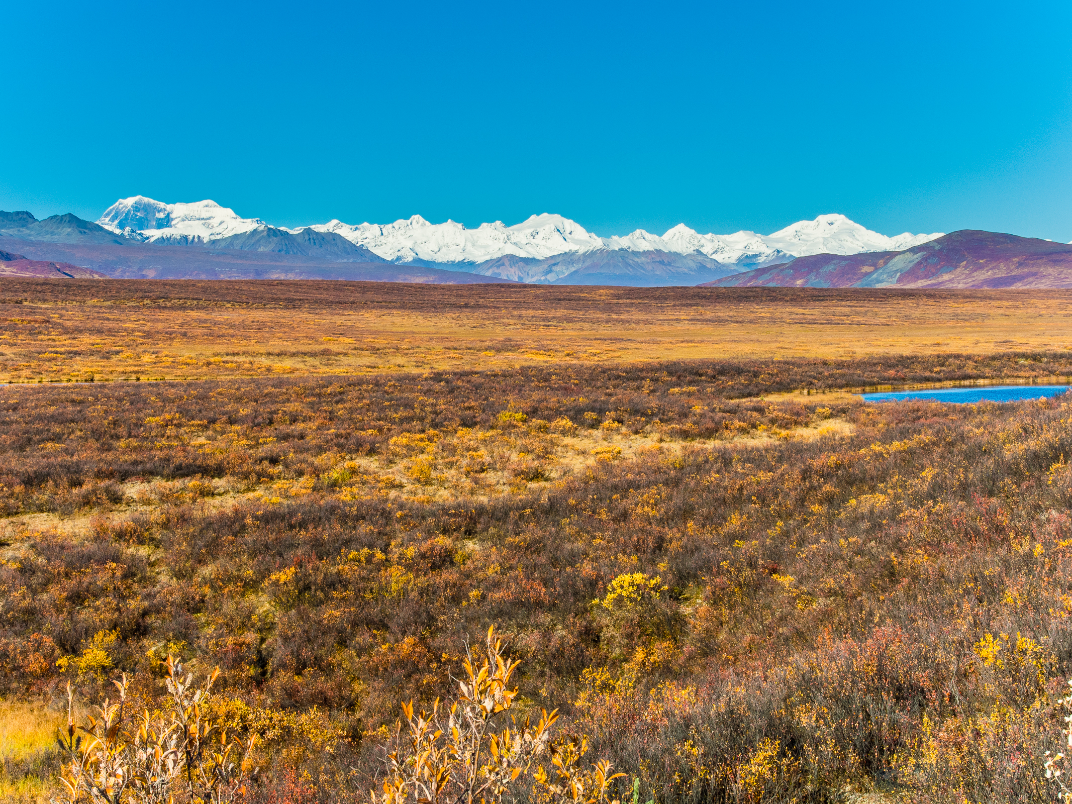
 and 13,020-foot Mt Moffit (right). The other two tall peaks, middle and right, are unnamed (at least on Google Earth). The peak on the horizon about 2/3 of the way from Mt Moffit to the unnamed middle peak is 11,400-foot McGinnis Peak. From Denali Highway in Alaska.")
Alaska Range from Mile 52 Denali Highway. The left-most double peak is 12,510-foot Mt Shand (left) and 13,020-foot Mt Moffit (right). The other two tall peaks, middle and right, are unnamed (at least on Google Earth). The peak on the horizon about 2/3 of the way from Mt Moffit to the unnamed middle peak is 11,400-foot McGinnis Peak.
Troutnut.com is a collection of pictures and information about fly fishing. Fly fishermen, fly tiers, and trout enthusiasts of all stripes can learn more about life beneath the surface of trout streams, as well as how to better imitate aquatic insects with artificial flies to catch trout. There are aquatic insect pictures, underwater pictures, landscape pictures, and a comprehensive reference to the common names of trout stream insects.